Weather Alerts for Wyoming
1. Avalanche Warning for: Star Valley; Salt River and Wyoming Ranges
2. High Wind Warning for: Central Laramie County
3. High Wind Warning for: Central Laramie Range and Southwest Platte County
4. High Wind Warning for: East Laramie County
5. High Wind Warning for: East Platte County
6. High Wind Warning for: Ferris/Seminoe/Shirley Mountains; Shirley Basin; Central Carbon County
7. High Wind Warning for: Goshen County
8. High Wind Warning for: Green Mountains and Rattlesnake Range; Natrona County Lower Elevations
9. High Wind Warning for: Laramie Valley
10. High Wind Warning for: North Snowy Range Foothills
11. High Wind Warning for: South Laramie Range; South Laramie Range Foothills
12. High Wind Warning for: South Lincoln County; Rock Springs and Green River; Flaming Gorge; East Sweetwater County
13. High Wind Warning for: Upper North Platte River Basin
14. High Wind Warning for: Wind River Basin
15. High Wind Warning for: Wind River Mountains East; Upper Wind River Basin
16. High Wind Watch for: Absaroka Mountains
17. High Wind Watch for: Cody Foothills
18. Winter Storm Warning for: Absaroka Mountains
19. Winter Storm Warning for: Sierra Madre Range; Snowy Range
20. Winter Storm Warning for: Teton and Gros Ventre Mountains; Salt River and Wyoming Ranges
21. Winter Storm Warning for: Wind River Mountains West
22. Winter Storm Warning for: Yellowstone National Park
23. Winter Weather Advisory for: Bighorn Mountains West; Bighorn Mountains Southeast
Want more detail? Get the Complete 7 Day and Night Detailed Forecast!
Current U.S. National Radar--Current
The Current National Weather Radar is shown below with a UTC Time (subtract 5 hours from UTC to get Eastern Time).

National Weather Forecast--Current
The Current National Weather Forecast and National Weather Map are shown below.

National Weather Forecast for Tomorrow
Tomorrow National Weather Forecast and Tomorrow National Weather Map are show below.

North America Water Vapor (Moisture)
This map shows recent moisture content over North America. Bright and colored areas show high moisture (ie, clouds); brown indicates very little moisture present; black indicates no moisture.

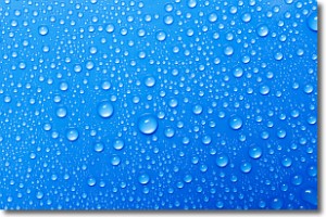
Weather Topic: What is Condensation?
Home - Education - Precipitation - Condensation
 Next Topic: Contrails
Condensation is the process which creates clouds, and therefore
it is a crucial process in the water cycle.
Condensation is the change of matter from a state of gas into a state of liquid,
and it happens because water molecules release heat into the atmosphere and
become organized into a more closely packed structure, what we might see as
water droplets.
Water is always present in the air around us as a vapor, but it's too small for
us to see. When water undergoes the process of condensation it becomes organized
into visible water droplets. You've probably seen condensation happen before on the
surface of a cold drink!
Next Topic: Contrails
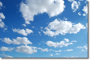
Weather Topic: What are Cumulonimbus Clouds?
Home - Education - Cloud Types - Cumulonimbus Clouds
 Next Topic: Cumulus Clouds
The final form taken by a growing cumulus cloud is the
cumulonimbus cloud, which is very tall and dense.
The tower of a cumulonimbus cloud can soar 23 km into the atmosphere, although
most commonly they stop growing at an altitude of 6 km.
Even small cumulonimbus clouds appear very large in comparison to other cloud types.
They can signal the approach of stormy weather, such as thunderstorms or blizzards.
Next Topic: Cumulus Clouds
Current conditions powered by WeatherAPI.com


