Weather Alert in Alaska
Winter Storm Warning issued February 22 at 9:59AM AKST until February 25 at 6:00AM AKST by NWS Fairbanks AK
AREAS AFFECTED: Upper Chena River Valley; Tanana Flats; Eielson AFB and Salcha; Goldstream Valley and Nenana Hills; Chatanika River Valley; Two Rivers; Fairbanks Metro Area; Nenana; Central Interior
DESCRIPTION: * WHAT...Heavy snow expected. Total snow accumulations between 12 and 18 inches. Winds could gust up to 30 mph. * WHERE...Central Interior, Nenana, Fairbanks North Star Borough * WHEN...Until 6 AM AKST Wednesday. * IMPACTS...Travel could be very difficult. * ADDITIONAL DETAILS...Multiple days of moderate snowfall expected beginning Sunday morning and lasting through Tuesday night. The heaviest snow is expected Monday with lighter snowfall continuing through Tuesday. Westerly winds strengthen through the Tanana Valley Tuesday which may lead to periods of blowing snow. Increased snow on frozen rivers and streams could lead to areas of overflow. Use caution while traveling on and along frozen waterways.
INSTRUCTION: If you must travel, keep an extra flashlight, food, and water in your vehicle in case of an emergency. Visit 511.alaska.gov or call 5 1 1 for the latest road conditions.
Want more detail? Get the Complete 7 Day and Night Detailed Forecast!
Current U.S. National Radar--Current
The Current National Weather Radar is shown below with a UTC Time (subtract 5 hours from UTC to get Eastern Time).

National Weather Forecast--Current
The Current National Weather Forecast and National Weather Map are shown below.

National Weather Forecast for Tomorrow
Tomorrow National Weather Forecast and Tomorrow National Weather Map are show below.

North America Water Vapor (Moisture)
This map shows recent moisture content over North America. Bright and colored areas show high moisture (ie, clouds); brown indicates very little moisture present; black indicates no moisture.

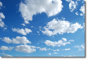
Weather Topic: What are Cumulonimbus Clouds?
Home - Education - Cloud Types - Cumulonimbus Clouds
 Next Topic: Cumulus Clouds
The final form taken by a growing cumulus cloud is the
cumulonimbus cloud, which is very tall and dense.
The tower of a cumulonimbus cloud can soar 23 km into the atmosphere, although
most commonly they stop growing at an altitude of 6 km.
Even small cumulonimbus clouds appear very large in comparison to other cloud types.
They can signal the approach of stormy weather, such as thunderstorms or blizzards.
Next Topic: Cumulus Clouds
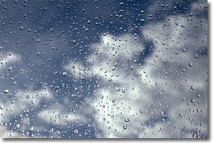
Weather Topic: What is Drizzle?
Home - Education - Precipitation - Drizzle
 Next Topic: Evaporation
Drizzle is precipitation in the form of water droplets which are
smaller than raindrops.
Drizzle is characterized by fine, gently falling droplets and typically does not
impact human habitation in a negative way. The exception to this is freezing drizzle,
a condition where drizzle freezes immediately upon reaching earth's surface.
Freezing drizzle is still less dangerous than freezing rain, but can
potentially result in hazardous road conditions.
Next Topic: Evaporation
Current conditions powered by WeatherAPI.com


