Weather Alert in Indiana
Special Weather Statement issued September 4 at 3:04AM EDT by NWS Wilmington OH
AREAS AFFECTED: Switzerland; Carroll; Gallatin; Boone; Kenton; Campbell; Owen; Grant; Pendleton; Bracken; Fayette; Warren; Clinton; Ross; Hamilton; Clermont; Brown; Highland
DESCRIPTION: At 304 AM EDT, strong thunderstorms were located along a line extending from 6 miles west of Wilmington to Kentucky Speedway, moving east at 35 mph. HAZARD...Wind gusts up to 40 mph. SOURCE...Radar indicated. IMPACT...Gusty winds could knock down tree limbs and blow around unsecured objects. Locations impacted include... Cincinnati, Covington, Florence, Independence, Norwood, Erlanger, Fort Thomas, Newport, Wilmington, Blue Ash, Loveland, Montgomery, Madeira, Edgewood, Alexandria, Elsmere, Fort Mitchell, Villa Hills, Highland Heights, and Milford. This includes the following Interstates... I-71 in Kentucky between mile markers 39 and 77. I-71 in Ohio between mile markers 0 and 15, and between mile markers 33 and 42. I-75 in Kentucky between mile markers 143 and 191. I-75 in Ohio between mile markers 0 and 2. If outdoors, consider seeking shelter inside a sturdy building. To report hazardous weather conditions, go to our website at weather.gov/iln and submit your report via social media, when you can do so safely.
INSTRUCTION: N/A
Want more detail? Get the Complete 7 Day and Night Detailed Forecast!
Current U.S. National Radar--Current
The Current National Weather Radar is shown below with a UTC Time (subtract 5 hours from UTC to get Eastern Time).

National Weather Forecast--Current
The Current National Weather Forecast and National Weather Map are shown below.

National Weather Forecast for Tomorrow
Tomorrow National Weather Forecast and Tomorrow National Weather Map are show below.

North America Water Vapor (Moisture)
This map shows recent moisture content over North America. Bright and colored areas show high moisture (ie, clouds); brown indicates very little moisture present; black indicates no moisture.

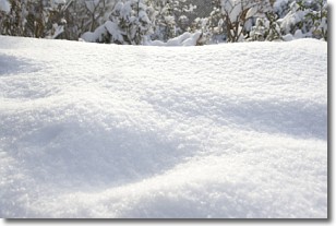
Weather Topic: What is Snow?
Home - Education - Precipitation - Snow
 Next Topic: Stratocumulus Clouds
Snow is precipitation taking the form of ice crystals. Each ice crystal, or snowflake,
has unique characteristics, but all of them grow in a hexagonal structure.
Snowfall can last for sustained periods of time and result in significant buildup
of snow on the ground.
On the earth's surface, snow starts out light and powdery, but as it begins to melt
it tends to become more granular, producing small bits of ice which have the consistency of
sand. After several cycles of melting and freezing, snow can become very dense
and ice-like, commonly known as snow pack.
Next Topic: Stratocumulus Clouds
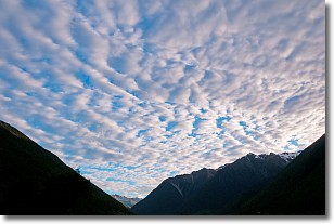
Weather Topic: What are Stratus Clouds?
Home - Education - Cloud Types - Stratus Clouds
 Next Topic: Wall Clouds
Stratus clouds are similar to altostratus clouds, but form at a
lower altitude and are identified by their fog-like appearance, lacking the
distinguishing features of most clouds.
Stratus clouds are wider than most clouds, and their base has a smooth, uniform
look which is lighter in color than a nimbostratus cloud.
The presence of a stratus cloud indicates the possibility of minor precipitation,
such as drizzle, but heavier precipitation does not typically arrive in the form
of a stratus cloud.
Next Topic: Wall Clouds
Current conditions powered by WeatherAPI.com


