Weather Alert in Utah
Winter Weather Advisory issued February 23 at 10:13PM MST until February 25 at 5:00PM MST by NWS Salt Lake City UT
AREAS AFFECTED: Wasatch Mountains I-80 North; Wasatch Mountains South of I-80; Western Uinta Mountains
DESCRIPTION: * WHAT...Snow expected above 8000 feet. Above 8000 feet, 2 to 8 inches expected. Above 9000 feet, 6 to 16 inches expected. Locally higher amounts to 18 inches possible for the Bear River Range and Upper Cottonwoods. Winds gusting as high as 80 mph across exposed mountain ridgelines. * WHERE...The Wasatch Mountains, and Western Uinta Mountains. * WHEN...From 8 AM Tuesday to 5 PM MST Wednesday. * IMPACTS...Travel could be difficult at times along high elevation routes like Logan Summit, the Upper Cottonwoods, and Wolf Creek Pass. Traction law restrictions may be enacted. Gusty winds could bring down tree branches. * ADDITIONAL DETAILS...Snow levels begin around 6500 feet at the onset of precipitation, but quickly rise to around 8000 feet by Tuesday afternoon. Snow levels may rise as high as 10000 feet overnight under heavy precipitation. Snow character will be heavy and wet given the warm nature of this storm.
INSTRUCTION: Dangerous conditions already exist in the backcountry, per the Utah Avalanche Center. Heavy, wet snow is expected, so backcountry users should exercise extra caution and consult utahavalanchecenter.org for avalanche forecasts. Slow down and use caution while traveling. For winter road conditions from the Utah Department of Transportation, visit http://www.udottraffic.utah.gov. For graphical depictions of the snowfall forecast, including Official NWS Forecast, High End Amount, and Low End Amount, visit weather.gov/slc/winter.
Want more detail? Get the Complete 7 Day and Night Detailed Forecast!
Current U.S. National Radar--Current
The Current National Weather Radar is shown below with a UTC Time (subtract 5 hours from UTC to get Eastern Time).

National Weather Forecast--Current
The Current National Weather Forecast and National Weather Map are shown below.

National Weather Forecast for Tomorrow
Tomorrow National Weather Forecast and Tomorrow National Weather Map are show below.

North America Water Vapor (Moisture)
This map shows recent moisture content over North America. Bright and colored areas show high moisture (ie, clouds); brown indicates very little moisture present; black indicates no moisture.

Weather Topic: What are Cumulus Clouds?
Home - Education - Cloud Types - Cumulus Clouds
 Next Topic: Drizzle
Cumulus clouds are fluffy and textured with rounded tops, and
may have flat bottoms. The border of a cumulus cloud
is clearly defined, and can have the appearance of cotton or cauliflower.
Cumulus clouds form at low altitudes (rarely above 2 km) but can grow very tall,
becoming cumulus congestus and possibly the even taller cumulonimbus clouds.
When cumulus clouds become taller, they have a greater chance of producing precipitation.
Next Topic: Drizzle
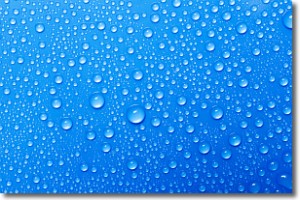
Weather Topic: What is Evaporation?
Home - Education - Precipitation - Evaporation
 Next Topic: Fog
Evaporation is the process which returns water from the earth
back to the atmosphere, and is another crucial process in the water cycle.
Evaporation is the transformation of liquid into gas, and it happens because
molecules are excited by the application of energy and turn into vapor.
In order for water to evaporate it has to be on the surface of a body of water.
Next Topic: Fog
Current conditions powered by WeatherAPI.com


