Weather Alert in Arizona
Flood Warning issued September 6 at 4:21AM PDT until September 6 at 7:15AM PDT by NWS Las Vegas NV
AREAS AFFECTED: Mohave, AZ
DESCRIPTION: * WHAT...Flooding caused by excessive rainfall is ongoing. * WHERE...A portion of northwest Arizona, including the following county, Mohave. * WHEN...Until 715 AM MST. * IMPACTS...Flooding of creeks, streams, and other low-lying and flood-prone locations is imminent or occurring. Low-water crossings are inundated with water and may not be passable. It will take several hours for all the water from these storms to work through local drainage systems in urban areas. * ADDITIONAL DETAILS... - At 421 AM MST, Doppler radar and automated rain gauges indicated heavy rain due to thunderstorms. Flooding is ongoing or expected to begin shortly in the warned area. Between 1 and 4 inches of rain have fallen. - Flooding impacts will continue, but no additional rainfall is expected. - Some locations that will experience flooding include... Temple Bar Campground, Meadview, South Cove, Pierce Ferry And Antares Roads, Grand Canyon Ranch, Dolan Springs, Grand Canyon Skywalk and Temple Bar. - This includes the Colorado River between mile markers 260 and 281. - http://www.weather.gov/safety/flood
INSTRUCTION: Turn around, don't drown when encountering flooded roads. Most flood deaths occur in vehicles. Be especially cautious at night when it is harder to recognize the dangers of flooding. In hilly terrain there are hundreds of low water crossings which are potentially dangerous in heavy rain. Do not attempt to cross flooded roads. Find an alternate route.
Want more detail? Get the Complete 7 Day and Night Detailed Forecast!
Current U.S. National Radar--Current
The Current National Weather Radar is shown below with a UTC Time (subtract 5 hours from UTC to get Eastern Time).

National Weather Forecast--Current
The Current National Weather Forecast and National Weather Map are shown below.

National Weather Forecast for Tomorrow
Tomorrow National Weather Forecast and Tomorrow National Weather Map are show below.

North America Water Vapor (Moisture)
This map shows recent moisture content over North America. Bright and colored areas show high moisture (ie, clouds); brown indicates very little moisture present; black indicates no moisture.

Weather Topic: What are Cumulus Clouds?
Home - Education - Cloud Types - Cumulus Clouds
 Next Topic: Drizzle
Cumulus clouds are fluffy and textured with rounded tops, and
may have flat bottoms. The border of a cumulus cloud
is clearly defined, and can have the appearance of cotton or cauliflower.
Cumulus clouds form at low altitudes (rarely above 2 km) but can grow very tall,
becoming cumulus congestus and possibly the even taller cumulonimbus clouds.
When cumulus clouds become taller, they have a greater chance of producing precipitation.
Next Topic: Drizzle
Weather Topic: What is Evaporation?
Home - Education - Precipitation - Evaporation
 Next Topic: Fog
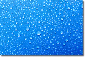
Evaporation is the process which returns water from the earth
back to the atmosphere, and is another crucial process in the water cycle.
Evaporation is the transformation of liquid into gas, and it happens because
molecules are excited by the application of energy and turn into vapor.
In order for water to evaporate it has to be on the surface of a body of water.
Next Topic: Fog
Current conditions powered by WeatherAPI.com


