Weather Alert in Alaska
Extreme Cold Watch issued February 24 at 10:04AM AKST until February 26 at 6:00PM AKST by NWS Anchorage AK
AREAS AFFECTED: Sutton / Upper Matanuska Valley; Eureka / Tahneta Pass; West Prince William Sound & Whittier; Northern Copper Valley; Western Copper Valley; Central Copper Valley; Ernestine; Northern Susitna Valley; Southern Copper Valley; Tok Cutoff; McCarthy
DESCRIPTION: * WHAT...Dangerously cold wind chills as low as 20 below possible for areas along the coast, including Whittier. Dangerously cold wind chills as low as 40 below to 50 below possible for Copper River Basin, northern Susitna Valley, and Upper Matanuska Valley. * WHERE...Copper River Basin, Sutton, Upper Matanuska Valley, Eureka, Tahneta Pass, West Prince William Sound & Whittier, and Northern Susitna Valley. * WHEN...From Wednesday evening through Thursday afternoon. * IMPACTS...For areas along the coast, dangerously cold wind chills as low as 20 below zero could cause frostbite on exposed skin in as little as 20 minutes. For interior valleys, wind chills as low as 50 below zero could cause frostbite on exposed skin in as little as 5 minutes. * ADDITIONAL DETAILS...Northerly winds will rapidly strengthen Tuesday afternoon and evening, then peak Tuesday night through Wednesday. Winds will then begin to slowly diminish Wednesday night through Thursday. Wind chills as low as 20 to 50 below zero overnight Wednesday could result in hypothermia or frostbite if precautions are not taken.
INSTRUCTION: An extreme cold watch means that a period of very cold temperatures are possible. Wear protective clothing such as a hat, face mask, and heavy gloves or mittens if you have plans to be outdoors. To prevent freezing and possible bursting of outdoor water pipes they should be wrapped, drained, or allowed to drip slowly.
Want more detail? Get the Complete 7 Day and Night Detailed Forecast!
Current U.S. National Radar--Current
The Current National Weather Radar is shown below with a UTC Time (subtract 5 hours from UTC to get Eastern Time).

National Weather Forecast--Current
The Current National Weather Forecast and National Weather Map are shown below.

National Weather Forecast for Tomorrow
Tomorrow National Weather Forecast and Tomorrow National Weather Map are show below.

North America Water Vapor (Moisture)
This map shows recent moisture content over North America. Bright and colored areas show high moisture (ie, clouds); brown indicates very little moisture present; black indicates no moisture.

Weather Topic: What are Hole Punch Clouds?
Home - Education - Cloud Types - Hole Punch Clouds
 Next Topic: Mammatus Clouds
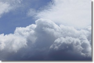
A hole punch cloud is an unusual occurrence when a disk-shaped
hole appears in a cirrostratus, cirrocumulus, or altocumulus cloud.
When part of the cloud forms ice crystals, water droplets in the surrounding area
of the cloud evaporate. The effect of this process produces a large elliptical
gap in the cloud. The hole punch cloud formation is rare, but it is not specific
to any geographic area.
Other names which have been used to describe this phenomena include fallstreak hole,
skypunch, and cloud hole.
Next Topic: Mammatus Clouds
Weather Topic: What are Nimbostratus Clouds?
Home - Education - Cloud Types - Nimbostratus Clouds
 Next Topic: Precipitation
A nimbostratus cloud is similar to a stratus cloud in its formless,
smooth appearance. However, a nimbostratus cloud is darker than a stratus cloud,
because it is thicker.
Unlike a stratus cloud, a nimbostratus cloud typically brings with it the threat
of moderate to heavy precipitation. In some cases, the precipitation may evaporate
before reaching the ground, a phenomenon known as virga.
Next Topic: Precipitation
Current conditions powered by WeatherAPI.com


