Weather Alert in Florida
Coastal Flood Statement issued August 22 at 4:00AM EDT until August 22 at 5:00PM EDT by NWS Key West FL
AREAS AFFECTED: Monroe Upper Keys
DESCRIPTION: * WHAT...Minor saltwater flooding. * WHERE...Upper Florida Keys. * WHEN...Through this afternoon. * IMPACTS...Minor saltwater flooding of low elevation streets and lots is likely. Some storm drains will overflow, and some seawalls and docks will be overtopped. Boaters can expect less clearance under fixed bridges. Motorists should remember that persistent puddles around the times of high tide are almost certain to contain a mix of saltwater.
INSTRUCTION: Do not drive through flooded roadways.
Want more detail? Get the Complete 7 Day and Night Detailed Forecast!
Current U.S. National Radar--Current
The Current National Weather Radar is shown below with a UTC Time (subtract 5 hours from UTC to get Eastern Time).

National Weather Forecast--Current
The Current National Weather Forecast and National Weather Map are shown below.

National Weather Forecast for Tomorrow
Tomorrow National Weather Forecast and Tomorrow National Weather Map are show below.

North America Water Vapor (Moisture)
This map shows recent moisture content over North America. Bright and colored areas show high moisture (ie, clouds); brown indicates very little moisture present; black indicates no moisture.

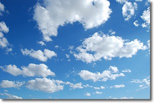
Weather Topic: What are Cumulonimbus Clouds?
Home - Education - Cloud Types - Cumulonimbus Clouds
 Next Topic: Cumulus Clouds
The final form taken by a growing cumulus cloud is the
cumulonimbus cloud, which is very tall and dense.
The tower of a cumulonimbus cloud can soar 23 km into the atmosphere, although
most commonly they stop growing at an altitude of 6 km.
Even small cumulonimbus clouds appear very large in comparison to other cloud types.
They can signal the approach of stormy weather, such as thunderstorms or blizzards.
Next Topic: Cumulus Clouds
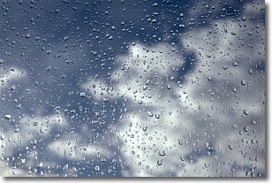
Weather Topic: What is Drizzle?
Home - Education - Precipitation - Drizzle
 Next Topic: Evaporation
Drizzle is precipitation in the form of water droplets which are
smaller than raindrops.
Drizzle is characterized by fine, gently falling droplets and typically does not
impact human habitation in a negative way. The exception to this is freezing drizzle,
a condition where drizzle freezes immediately upon reaching earth's surface.
Freezing drizzle is still less dangerous than freezing rain, but can
potentially result in hazardous road conditions.
Next Topic: Evaporation
Current conditions powered by WeatherAPI.com


