Weather Alert in Montana
Avalanche Warning issued February 25 at 8:24AM MST by NWS Missoula MT
AREAS AFFECTED: Potomac/Seeley Lake Region
DESCRIPTION: AVWMSO The following message is transmitted at the request of West Central Montana Avalanche Center Missoula MT. ...AVALANCHE WARNING ISSUED BY THE WEST CENTRAL MONTANA AVALANCHE CENTER... 07:30 MST Wed Feb 25 2026 The West Central Montana Avalanche Center in Missoula has issued a BACKCOUNTRY AVALANCHE WARNING for the following areas: NWS Missoula MT - MTZ043 (MTZ043) * WHAT...Several feet of new snow, coupled with strong ridgetop winds, have created dangerous avalanche conditions. This new snow will likely overload buried weak layers and lead to large natural avalanches. Travel in and below avalanche terrain is not recommended. * WHERE...The Seeley Lake mountains above 5500'. * WHEN...In effect from Wed 07:30 MST to Thu 04:00 MST. * IMPACTS...Natural and human-triggered avalanches are likely. Avalanches will release on weak layers buried two to four feet deep. It will be possible to remotely trigger avalanches from below, above, or to the side of steeper slopes. Avalanches may connect across terrain features, creating large and destructive avalanches. * PRECAUTIONARY / PREPAREDNESS ACTIONS...Dangerous avalanche conditions exist. Travel in avalanche terrain is not recommended. Avoid travel underneath steep slopes. Even small slopes like roadcuts and gullies have potential to deposit enough debris to bury or injure a person. Consult https://missoulaavalanche.org/ or www.avalanche.org for more detailed information. Similar avalanche danger may exist at locations outside the coverage area of this or any avalanche center.
INSTRUCTION: N/A
Want more detail? Get the Complete 7 Day and Night Detailed Forecast!
Current U.S. National Radar--Current
The Current National Weather Radar is shown below with a UTC Time (subtract 5 hours from UTC to get Eastern Time).

National Weather Forecast--Current
The Current National Weather Forecast and National Weather Map are shown below.

National Weather Forecast for Tomorrow
Tomorrow National Weather Forecast and Tomorrow National Weather Map are show below.

North America Water Vapor (Moisture)
This map shows recent moisture content over North America. Bright and colored areas show high moisture (ie, clouds); brown indicates very little moisture present; black indicates no moisture.

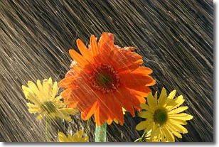
Weather Topic: What is Rain?
Home - Education - Precipitation - Rain
 Next Topic: Shelf Clouds
Precipitation in the form of water droplets is called rain.
Rain generally has a tendency to fall with less intensity over a greater period
of time, and when rainfall is more severe it is usually less sustained.
Rain is the most common form of precipitation and happens with greater frequency
depending on the season and regional influences. Cities have been shown to have
an observable effect on rainfall, due to an effect called the urban heat island.
Compared to upwind, monthly rainfall between twenty and forty miles downwind of
cities is 30% greater.
Next Topic: Shelf Clouds
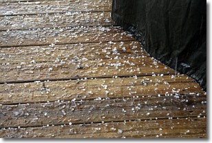
Weather Topic: What is Sleet?
Home - Education - Precipitation - Sleet
 Next Topic: Snow
Sleet is a form of precipitation in which small ice pellets are the primary
components. These ice pellets are smaller and more translucent than hailstones,
and harder than graupel. Sleet is caused by specific atmospheric conditions and
therefore typically doesn't last for extended periods of time.
The condition which leads to sleet formation requires a warmer body of air to be
wedged in between two sub-freezing bodies of air. When snow falls through a warmer
layer of air it melts, and as it falls through the next sub-freezing body of air
it freezes again, forming ice pellets known as sleet. In some cases, water
droplets don't have time to freeze before reaching the surface and the result is
freezing rain.
Next Topic: Snow
Current conditions powered by WeatherAPI.com


