Weather Alert in Arizona
Fire Weather Watch issued May 2 at 1:09AM MST until May 4 at 8:00PM MST by NWS Tucson AZ
AREAS AFFECTED: Pima-South Central Pinal-Tohono Oodham Nation; Eastern Pima-Southeastern Pinal-Santa Cruz-Western Cochise; Southern Graham-Central and Eastern Cochise-Southern Greenlee-Lower Elevations of the San Carlos Apache Nation in Graham County; Northern Graham-Northern Greenlee-White and Gila Mountains
DESCRIPTION: * AFFECTED AREA...Fire Weather Zones 150, 151, 152 and 153. * TIMING...From Sunday morning through Sunday evening. * WINDS...Southwest 15 to 25 mph with gusts up to 45 mph. The strongest winds will be near the International Border in Santa Cruz and Cochise counties as well as along the Arizona/New Mexico border in Cochise county. * RELATIVE HUMIDITY...11 to 16 percent. * IMPACTS...Any fires that develop or are ongoing will have the potential to spread rapidly.
INSTRUCTION: A Fire Weather Watch means that critical fire weather conditions are forecast to occur. Listen for later forecasts and possible Red Flag Warnings. Please advise the appropriate officials or fire crews in the field of the Fire Weather Watch for portions of Southeast Arizona.
Want more detail? Get the Complete 7 Day and Night Detailed Forecast!
Current U.S. National Radar--Current
The Current National Weather Radar is shown below with a UTC Time (subtract 5 hours from UTC to get Eastern Time).

National Weather Forecast--Current
The Current National Weather Forecast and National Weather Map are shown below.

National Weather Forecast for Tomorrow
Tomorrow National Weather Forecast and Tomorrow National Weather Map are show below.

North America Water Vapor (Moisture)
This map shows recent moisture content over North America. Bright and colored areas show high moisture (ie, clouds); brown indicates very little moisture present; black indicates no moisture.

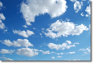
Weather Topic: What are Cumulonimbus Clouds?
Home - Education - Cloud Types - Cumulonimbus Clouds
 Next Topic: Cumulus Clouds
The final form taken by a growing cumulus cloud is the
cumulonimbus cloud, which is very tall and dense.
The tower of a cumulonimbus cloud can soar 23 km into the atmosphere, although
most commonly they stop growing at an altitude of 6 km.
Even small cumulonimbus clouds appear very large in comparison to other cloud types.
They can signal the approach of stormy weather, such as thunderstorms or blizzards.
Next Topic: Cumulus Clouds
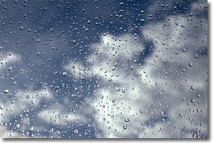
Weather Topic: What is Drizzle?
Home - Education - Precipitation - Drizzle
 Next Topic: Evaporation
Drizzle is precipitation in the form of water droplets which are
smaller than raindrops.
Drizzle is characterized by fine, gently falling droplets and typically does not
impact human habitation in a negative way. The exception to this is freezing drizzle,
a condition where drizzle freezes immediately upon reaching earth's surface.
Freezing drizzle is still less dangerous than freezing rain, but can
potentially result in hazardous road conditions.
Next Topic: Evaporation
Current conditions powered by WeatherAPI.com


