Weather Alert in New York
Coastal Flood Warning Flood Advisory Winter Storm Warning Winter Weather Advisory
Winter Storm Warning issued February 22 at 6:55PM EST until February 23 at 7:00PM EST by NWS Albany NY
AREAS AFFECTED: Schoharie; Western Schenectady; Eastern Schenectady; Western Albany; Eastern Albany; Western Rensselaer; Eastern Rensselaer; Bennington; Western Windham; Eastern Windham
DESCRIPTION: * WHAT...Heavy snow expected. Total snow accumulations between 4 and 10 inches across Schoharie County, the Helderbergs, Capital Region and northern Taconics of eastern New York and 6 to 12 inches across southern Vermont. Winds gusting as high as 40 mph. * WHERE...Schoharie, Schenectady, Albany and Rensselaer Counties in eastern New York and Bennington and Windham Counties in southern Vermont. * WHEN...Until 7 PM EST Monday. * IMPACTS...Travel could be difficult. Visibility will be reduced late tonight into Monday morning due to falling and blowing snow. The hazardous conditions could impact the Monday morning commute and possibly the evening commute as well for eastern areas. * ADDITIONAL DETAILS...A powerful nor'easter will impact the region tonight through Monday. There will be a sharp gradient of snowfall totals and the higher snowfall amounts will be favored across the higher elevations and southern parts of the area. Snowfall rates could approach one inch per hour within bands late tonight into Monday morning.
INSTRUCTION: If you must travel, keep an extra flashlight, food, and water in your vehicle in case of an emergency.
Want more detail? Get the Complete 7 Day and Night Detailed Forecast!
Current U.S. National Radar--Current
The Current National Weather Radar is shown below with a UTC Time (subtract 5 hours from UTC to get Eastern Time).

National Weather Forecast--Current
The Current National Weather Forecast and National Weather Map are shown below.

National Weather Forecast for Tomorrow
Tomorrow National Weather Forecast and Tomorrow National Weather Map are show below.

North America Water Vapor (Moisture)
This map shows recent moisture content over North America. Bright and colored areas show high moisture (ie, clouds); brown indicates very little moisture present; black indicates no moisture.

Weather Topic: What is Evaporation?
Home - Education - Precipitation - Evaporation
 Next Topic: Fog
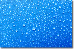
Evaporation is the process which returns water from the earth
back to the atmosphere, and is another crucial process in the water cycle.
Evaporation is the transformation of liquid into gas, and it happens because
molecules are excited by the application of energy and turn into vapor.
In order for water to evaporate it has to be on the surface of a body of water.
Next Topic: Fog
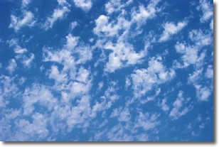
Weather Topic: What are Fractus Clouds?
Home - Education - Cloud Types - Fractus Clouds
 Next Topic: Freezing Rain
A fractus cloud (scud) is a fragmented, tattered cloud which has
likely been sheared off of another cloud. They are accessory clouds, meaning they
develop from parent clouds, and are named in a way which describes the original
cloud which contained them.
Fractus clouds which have originated from cumulus clouds are referred to as
cumulus fractus, while fractus clouds which have originated from stratus clouds
are referred to as stratus fractus. Under certain conditions a fractus cloud might
merge with another cloud, or develop into a cumulus cloud, but usually a
fractus cloud seen by itself will dissipate rapidly.
They are often observed on the leading and trailing edges of storm clouds,
and are a display of wind activity.
Next Topic: Freezing Rain
Current conditions powered by WeatherAPI.com


