Weather Alert in South Dakota
Red Flag Warning issued March 17 at 9:23PM MDT until March 18 at 7:00PM MDT by NWS Rapid City SD
AREAS AFFECTED: Fall River County Area; Southern Campbell; Weston County Plains
DESCRIPTION: ...CRITICAL FIRE WEATHER CONDITIONS WEDNESDAY ACROSS PORTIONS OF NORTHEASTERN WYOMING AND FAR SOUTHWESTERN SOUTH DAKOTA... .Very warm temperatures Wednesday with highs in the upper 60s into mid 70s across northeastern Wyoming and southwestern South Dakota. These anomalously warm temperatures coupled with gusty west-northwest winds (gusts 25 to 40 mph) and relative humidity falling to around 15 percent will result in critical fire weather conditions Wednesday afternoon and early evening. * AFFECTED AREA...Fire Weather Zones 315 Southern Campbell, 317 Weston County Plains and 322 Fall River County Area. * WINDS...West-northwest 10 to 20 mph with gusts up to 40 mph. * RELATIVE HUMIDITY...As low as 13 percent. * IMPACTS...The combination of gusty winds and low relative humidity will produce critical fire weather conditions.
INSTRUCTION: A Red Flag Warning means that critical fire weather conditions are either occurring now, or will shortly. A combination of strong winds, low relative humidity, and warm temperatures can contribute to extreme fire behavior.
Want more detail? Get the Complete 7 Day and Night Detailed Forecast!
Current U.S. National Radar--Current
The Current National Weather Radar is shown below with a UTC Time (subtract 5 hours from UTC to get Eastern Time).

National Weather Forecast--Current
The Current National Weather Forecast and National Weather Map are shown below.

National Weather Forecast for Tomorrow
Tomorrow National Weather Forecast and Tomorrow National Weather Map are show below.

North America Water Vapor (Moisture)
This map shows recent moisture content over North America. Bright and colored areas show high moisture (ie, clouds); brown indicates very little moisture present; black indicates no moisture.

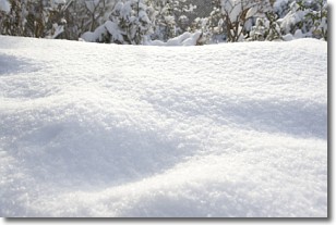
Weather Topic: What is Snow?
Home - Education - Precipitation - Snow
 Next Topic: Stratocumulus Clouds
Snow is precipitation taking the form of ice crystals. Each ice crystal, or snowflake,
has unique characteristics, but all of them grow in a hexagonal structure.
Snowfall can last for sustained periods of time and result in significant buildup
of snow on the ground.
On the earth's surface, snow starts out light and powdery, but as it begins to melt
it tends to become more granular, producing small bits of ice which have the consistency of
sand. After several cycles of melting and freezing, snow can become very dense
and ice-like, commonly known as snow pack.
Next Topic: Stratocumulus Clouds
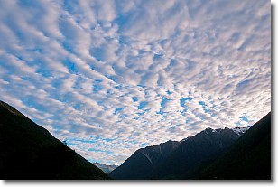
Weather Topic: What are Stratus Clouds?
Home - Education - Cloud Types - Stratus Clouds
 Next Topic: Wall Clouds
Stratus clouds are similar to altostratus clouds, but form at a
lower altitude and are identified by their fog-like appearance, lacking the
distinguishing features of most clouds.
Stratus clouds are wider than most clouds, and their base has a smooth, uniform
look which is lighter in color than a nimbostratus cloud.
The presence of a stratus cloud indicates the possibility of minor precipitation,
such as drizzle, but heavier precipitation does not typically arrive in the form
of a stratus cloud.
Next Topic: Wall Clouds
Current conditions powered by WeatherAPI.com


