Weather Alert in Idaho
Flash Flood Warning issued August 26 at 6:05PM MDT until August 26 at 9:00PM MDT by NWS Boise ID
AREAS AFFECTED: Boise, ID
DESCRIPTION: FFWBOI The National Weather Service in Boise has issued a * Flash Flood Warning for... East Central Boise County in southwestern Idaho... * Until 900 PM MDT. * At 605 PM MDT, Boise County law enforcement reported numerous 911 calls about rock slides and standing water on Idaho State Highway 21 between Lowman and Grandjean. Flash flooding is ongoing. HAZARD...Flash flooding caused by thunderstorms. SOURCE...Law enforcement reported. IMPACT...Flash flooding of small creeks and streams, as well as other poor drainage and low-lying areas. Rock slides were reported on Idaho State Highway 21 at mileposts 72 and 76-77. Three feet of water was reported on the road at milepost 80.
INSTRUCTION: Stay away or be swept away. River banks and culverts can become unstable and unsafe. In hilly terrain there are hundreds of low water crossings which are potentially dangerous in heavy rain. Do not attempt to cross flooded roads. Find an alternate route.
Want more detail? Get the Complete 7 Day and Night Detailed Forecast!
Current U.S. National Radar--Current
The Current National Weather Radar is shown below with a UTC Time (subtract 5 hours from UTC to get Eastern Time).

National Weather Forecast--Current
The Current National Weather Forecast and National Weather Map are shown below.

National Weather Forecast for Tomorrow
Tomorrow National Weather Forecast and Tomorrow National Weather Map are show below.

North America Water Vapor (Moisture)
This map shows recent moisture content over North America. Bright and colored areas show high moisture (ie, clouds); brown indicates very little moisture present; black indicates no moisture.

Weather Topic: What are Hole Punch Clouds?
Home - Education - Cloud Types - Hole Punch Clouds
 Next Topic: Mammatus Clouds
A hole punch cloud is an unusual occurrence when a disk-shaped
hole appears in a cirrostratus, cirrocumulus, or altocumulus cloud.
When part of the cloud forms ice crystals, water droplets in the surrounding area
of the cloud evaporate. The effect of this process produces a large elliptical
gap in the cloud. The hole punch cloud formation is rare, but it is not specific
to any geographic area.
Other names which have been used to describe this phenomena include fallstreak hole,
skypunch, and cloud hole.
Next Topic: Mammatus Clouds
Weather Topic: What are Nimbostratus Clouds?
Home - Education - Cloud Types - Nimbostratus Clouds
 Next Topic: Precipitation
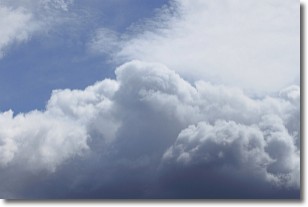
A nimbostratus cloud is similar to a stratus cloud in its formless,
smooth appearance. However, a nimbostratus cloud is darker than a stratus cloud,
because it is thicker.
Unlike a stratus cloud, a nimbostratus cloud typically brings with it the threat
of moderate to heavy precipitation. In some cases, the precipitation may evaporate
before reaching the ground, a phenomenon known as virga.
Next Topic: Precipitation
Current conditions powered by WeatherAPI.com


