Weather Alert in Iowa
Winter Weather Advisory issued February 27 at 11:59AM CST until February 28 at 6:00PM CST by NWS La Crosse WI
AREAS AFFECTED: Howard; Winneshiek; Allamakee; Dodge; Olmsted; Mower; Fillmore; Houston; Vernon; Crawford; Richland
DESCRIPTION: ...BAND OF SNOW MOVES IN SATURDAY MORNING... .A narrow band of snow will move in from the west on Saturday morning and continue throughout much of the daytime hours. Snowfall rates of an inch an hour will be possible within the band resulting in quick accumulations on roadways. Snowfall amounts within the band will likely range between 2 to 4 inches with locally higher amounts of up to 6 inches possible. The exact location of the heaviest amounts still remains uncertain with a sharp cutoff in amounts possible over just a few miles. As a result, be sure to continue to monitor the forecast for updates as the location of snowfall amounts may still shift. * WHAT...Snow expected. Total snow accumulations between 1 and 4 inches. Locally higher amounts will be possible. * WHERE...Portions of northeast Iowa, southeast Minnesota, and southwest Wisconsin. * WHEN...From 6 AM to 6 PM CST Saturday. * IMPACTS...Plan on slippery road conditions.
INSTRUCTION: Slow down and use caution while traveling. In Iowa, visit 511ia.org for road conditions. In Minnesota, visit 511mn.org for road conditions. In Wisconsin, visit 511wi.gov for road conditions.
Want more detail? Get the Complete 7 Day and Night Detailed Forecast!
Current U.S. National Radar--Current
The Current National Weather Radar is shown below with a UTC Time (subtract 5 hours from UTC to get Eastern Time).

National Weather Forecast--Current
The Current National Weather Forecast and National Weather Map are shown below.

National Weather Forecast for Tomorrow
Tomorrow National Weather Forecast and Tomorrow National Weather Map are show below.

North America Water Vapor (Moisture)
This map shows recent moisture content over North America. Bright and colored areas show high moisture (ie, clouds); brown indicates very little moisture present; black indicates no moisture.

Weather Topic: What are Cumulus Clouds?
Home - Education - Cloud Types - Cumulus Clouds
 Next Topic: Drizzle
Cumulus clouds are fluffy and textured with rounded tops, and
may have flat bottoms. The border of a cumulus cloud
is clearly defined, and can have the appearance of cotton or cauliflower.
Cumulus clouds form at low altitudes (rarely above 2 km) but can grow very tall,
becoming cumulus congestus and possibly the even taller cumulonimbus clouds.
When cumulus clouds become taller, they have a greater chance of producing precipitation.
Next Topic: Drizzle
Weather Topic: What is Evaporation?
Home - Education - Precipitation - Evaporation
 Next Topic: Fog
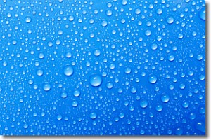
Evaporation is the process which returns water from the earth
back to the atmosphere, and is another crucial process in the water cycle.
Evaporation is the transformation of liquid into gas, and it happens because
molecules are excited by the application of energy and turn into vapor.
In order for water to evaporate it has to be on the surface of a body of water.
Next Topic: Fog
Current conditions powered by WeatherAPI.com


