Weather Alert in Kentucky
Winter Weather Advisory issued February 22 at 10:51PM EST until February 23 at 7:00PM EST by NWS Jackson KY
AREAS AFFECTED: Harlan; Floyd; Knott; Perry; Letcher; Martin; Pike
DESCRIPTION: * WHAT...Rounds of snow showers. Additional snow accumulations between 11 PM EST Sunday to 7 PM Monday of a half an inch to 2 inches. Locally higher amounts are possible in any areas of more persistent snow showers. Accumulations up to 4 inches are possible above 3000 feet elevation. * WHERE...Portions of northeast and southeast Kentucky. * WHEN...Until 7 PM EST Monday. * IMPACTS...Plan on times of slick, slushy, or snow covered roads and significant differences in road conditions over rather short distances. During or following a snow shower, any untreated roads and surfaces, as well as bridges and overpasses, may be icy in some locations. The hazardous conditions could impact the Monday morning and evening commutes.
INSTRUCTION: If traveling tonight or Monday, slow down and exercise caution while traveling. Allow plenty of extra time to reach your destination. The latest road conditions for Kentucky can be found by visiting https://goky.ky.gov.
Want more detail? Get the Complete 7 Day and Night Detailed Forecast!
Current U.S. National Radar--Current
The Current National Weather Radar is shown below with a UTC Time (subtract 5 hours from UTC to get Eastern Time).

National Weather Forecast--Current
The Current National Weather Forecast and National Weather Map are shown below.

National Weather Forecast for Tomorrow
Tomorrow National Weather Forecast and Tomorrow National Weather Map are show below.

North America Water Vapor (Moisture)
This map shows recent moisture content over North America. Bright and colored areas show high moisture (ie, clouds); brown indicates very little moisture present; black indicates no moisture.

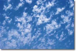
Weather Topic: What are Fractus Clouds?
Home - Education - Cloud Types - Fractus Clouds
 Next Topic: Freezing Rain
A fractus cloud (scud) is a fragmented, tattered cloud which has
likely been sheared off of another cloud. They are accessory clouds, meaning they
develop from parent clouds, and are named in a way which describes the original
cloud which contained them.
Fractus clouds which have originated from cumulus clouds are referred to as
cumulus fractus, while fractus clouds which have originated from stratus clouds
are referred to as stratus fractus. Under certain conditions a fractus cloud might
merge with another cloud, or develop into a cumulus cloud, but usually a
fractus cloud seen by itself will dissipate rapidly.
They are often observed on the leading and trailing edges of storm clouds,
and are a display of wind activity.
Next Topic: Freezing Rain
Weather Topic: What is Graupel?
Home - Education - Precipitation - Graupel
 Next Topic: Hail
Graupel is a form of precipitation that is created by atmospheric conditions
which cause supercooled water droplets to contact snow crystals and freeze to
their surface.
Sometimes known as soft hail or snow pellets, graupel is delicate and easily
destroyed by touch. Whereas hail usually falls during severe weather, graupel
doesn't require such conditions to form, and can form in mild precipitation
similar to situations which produce snowfall.
Next Topic: Hail
Current conditions powered by WeatherAPI.com


