Weather Alert in Wyoming
Air Quality Alert issued August 22 at 12:33PM MDT by NWS Riverton WY
AREAS AFFECTED: Wind River Mountains West; Upper Green River Basin Foothills; Upper Green River Basin
DESCRIPTION: The following message is transmitted on behalf of the Wyoming Department of Environmental Quality, Air Quality Division, and the Wyoming Department of Health. * WHAT...Air Quality Alert for Wildfire Smoke. * WHERE...Upper Green River Basin and Western Wind River Mountains. This includes the towns of, Pinedale, Big Piney/Marbleton, Hoback, and Farson. * WHEN...1 PM Friday August 22 until 1 PM Saturday August 23. * IMPACTS...Smoke from the Dollar Lake Wildfire continues to be observed across portions of western and central Wyoming. The smoke is limiting visibilities at times, especially at higher elevations in the Wind River Mountains. HEALTH INFORMATION...The Wyoming Department of Health recommends that the elderly, young children, and individuals with respiratory problems avoid excessive physical exertion and minimize outdoor activities during this time. Wildfire smoke is made up of a variety of pollutants, including particulate matter and ozone, which can cause respiratory health effects. Although these people are most susceptible to health impacts, the Department of Health also advises that everyone should avoid prolonged exposure to poor air quality conditions. CURRENT CONDITIONS...The Wyoming Department of Environmental Quality, Air Quality Division offers near real-time air quality data for Wyoming's monitoring stations and health effects information to help the public interpret current conditions. Current air quality conditions across the state of Wyoming can be found at http://www.wyvisnet.com/.
INSTRUCTION: N/A
Want more detail? Get the Complete 7 Day and Night Detailed Forecast!
Current U.S. National Radar--Current
The Current National Weather Radar is shown below with a UTC Time (subtract 5 hours from UTC to get Eastern Time).

National Weather Forecast--Current
The Current National Weather Forecast and National Weather Map are shown below.

National Weather Forecast for Tomorrow
Tomorrow National Weather Forecast and Tomorrow National Weather Map are show below.

North America Water Vapor (Moisture)
This map shows recent moisture content over North America. Bright and colored areas show high moisture (ie, clouds); brown indicates very little moisture present; black indicates no moisture.

Weather Topic: What is Evaporation?
Home - Education - Precipitation - Evaporation
 Next Topic: Fog
Evaporation is the process which returns water from the earth
back to the atmosphere, and is another crucial process in the water cycle.
Evaporation is the transformation of liquid into gas, and it happens because
molecules are excited by the application of energy and turn into vapor.
In order for water to evaporate it has to be on the surface of a body of water.
Next Topic: Fog
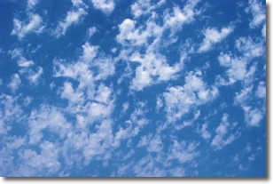
Weather Topic: What are Fractus Clouds?
Home - Education - Cloud Types - Fractus Clouds
 Next Topic: Freezing Rain
A fractus cloud (scud) is a fragmented, tattered cloud which has
likely been sheared off of another cloud. They are accessory clouds, meaning they
develop from parent clouds, and are named in a way which describes the original
cloud which contained them.
Fractus clouds which have originated from cumulus clouds are referred to as
cumulus fractus, while fractus clouds which have originated from stratus clouds
are referred to as stratus fractus. Under certain conditions a fractus cloud might
merge with another cloud, or develop into a cumulus cloud, but usually a
fractus cloud seen by itself will dissipate rapidly.
They are often observed on the leading and trailing edges of storm clouds,
and are a display of wind activity.
Next Topic: Freezing Rain
Current conditions powered by WeatherAPI.com


