Weather Alert in Arizona
Flash Flood Warning issued August 22 at 2:58PM MST until August 22 at 6:00PM MST by NWS Flagstaff AZ
AREAS AFFECTED: Coconino, AZ
DESCRIPTION: At 258 PM MST, Doppler radar indicated thunderstorms have diminished over the Dragon Bravo Fire Scar. Between 0.5 and 1 inch of rain fell earlier this afternoon, with only light rain continuing. Flash flooding is ongoing or expected to begin shortly. Excessive rainfall over the burn scar will result in debris flow moving through the Crystal Creek and Tuna Creek drainages toward the Colorado River. The debris flow can consist of rock, mud, vegetation and other loose materials. HAZARD...Life threatening flash flooding. Thunderstorms producing flash flooding in and around the Dragon Bravo Fire Scar. SOURCE...Radar indicated. IMPACT...Life threatening flash flooding of areas in and around the Dragon Bravo Fire Scar. Some locations that will experience flash flooding include... Grand Canyon National Park. This includes the Colorado River between river miles 93 and 101. This includes the following creeks, washes and rivers... Tuna Creek, Colorado River, Hermit Creek, Agate Canyon, Salt Creek, Travertine Canyon, Slate Creek, Boucher Creek, Crystal Creek, Shinumo Creek, Trinity Creek, Monument Creek and 94-Mile Creek.
INSTRUCTION: This is a life threatening situation. Heavy rainfall will cause extensive and severe flash flooding of creeks...streams...and ditches in the Dragon Bravo Fire Scar. Severe debris flows can also be anticipated across roads. Roads may be washed away in places. If you encounter flood waters...climb to safety.
Want more detail? Get the Complete 7 Day and Night Detailed Forecast!
Current U.S. National Radar--Current
The Current National Weather Radar is shown below with a UTC Time (subtract 5 hours from UTC to get Eastern Time).

National Weather Forecast--Current
The Current National Weather Forecast and National Weather Map are shown below.

National Weather Forecast for Tomorrow
Tomorrow National Weather Forecast and Tomorrow National Weather Map are show below.

North America Water Vapor (Moisture)
This map shows recent moisture content over North America. Bright and colored areas show high moisture (ie, clouds); brown indicates very little moisture present; black indicates no moisture.

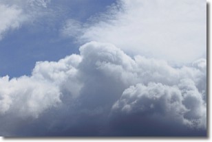
Weather Topic: What are Nimbostratus Clouds?
Home - Education - Cloud Types - Nimbostratus Clouds
 Next Topic: Precipitation
A nimbostratus cloud is similar to a stratus cloud in its formless,
smooth appearance. However, a nimbostratus cloud is darker than a stratus cloud,
because it is thicker.
Unlike a stratus cloud, a nimbostratus cloud typically brings with it the threat
of moderate to heavy precipitation. In some cases, the precipitation may evaporate
before reaching the ground, a phenomenon known as virga.
Next Topic: Precipitation
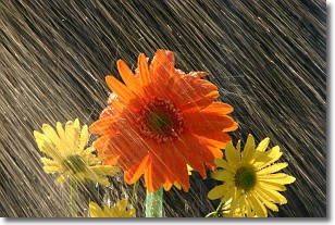
Weather Topic: What is Rain?
Home - Education - Precipitation - Rain
 Next Topic: Shelf Clouds
Precipitation in the form of water droplets is called rain.
Rain generally has a tendency to fall with less intensity over a greater period
of time, and when rainfall is more severe it is usually less sustained.
Rain is the most common form of precipitation and happens with greater frequency
depending on the season and regional influences. Cities have been shown to have
an observable effect on rainfall, due to an effect called the urban heat island.
Compared to upwind, monthly rainfall between twenty and forty miles downwind of
cities is 30% greater.
Next Topic: Shelf Clouds
Current conditions powered by WeatherAPI.com


