Weather Alert in Texas
Flash Flood Warning issued July 5 at 12:41AM CDT until July 5 at 5:00AM CDT by NWS Austin/San Antonio TX
AREAS AFFECTED: Travis, TX
DESCRIPTION: FFWEWX The National Weather Service in Austin/San Antonio has issued a * Flash Flood Warning for... Northwestern Travis County in south central Texas... * Until 500 AM CDT. * At 1241 AM CDT, local law enforcement reported thunderstorms producing heavy rain in FM 1431 north of Lake Travis. Between 3 and 7 inches of rain have fallen. The expected rainfall rate is 6 inches in 1 hour. Additional rainfall amounts of 2 to 5 inches are possible in the warned area. Flash flooding is already occurring. This is a FLASH FLOOD EMERGENCY for Western Travis County and far eastern Burnet County around Lake Travis. This is a PARTICULARLY DANGEROUS SITUATION. SEEK HIGHER GROUND NOW! HAZARD...Life threatening flash flooding. Thunderstorms producing flash flooding. SOURCE...Law enforcement reported. IMPACT...This is a PARTICULARLY DANGEROUS SITUATION. SEEK HIGHER GROUND NOW! Life threatening flash flooding of low water crossings, small creeks and streams, urban areas, highways, streets and underpasses. * Some locations that will experience flash flooding include... Cedar Park, Leander, Lago Vista, Jonestown and Briarcliff. This includes the following streams and drainages... Colorado River, Lick Creek, North Fork Brushy Creek, Fall Creek, Big Sandy Creek, Brushy Creek, Red Bluff Creek, South Fork Brushy Creek, Negro Branch, Cow Creek, Bee Creek and Post Oak Creek.
INSTRUCTION: Move to higher ground now! This is an extremely dangerous and life-threatening situation. Do not attempt to travel unless you are fleeing an area subject to flooding or under an evacuation order. Turn around, don't drown when encountering flooded roads. Most flood deaths occur in vehicles. Be especially cautious at night when it is harder to recognize the dangers of flooding. Flooding is occurring or is imminent. It is important to know where you are relative to streams, rivers, or creeks which can become killers in heavy rains. Campers and hikers should avoid streams or creeks.
Want more detail? Get the Complete 7 Day and Night Detailed Forecast!
Current U.S. National Radar--Current
The Current National Weather Radar is shown below with a UTC Time (subtract 5 hours from UTC to get Eastern Time).

National Weather Forecast--Current
The Current National Weather Forecast and National Weather Map are shown below.

National Weather Forecast for Tomorrow
Tomorrow National Weather Forecast and Tomorrow National Weather Map are show below.

North America Water Vapor (Moisture)
This map shows recent moisture content over North America. Bright and colored areas show high moisture (ie, clouds); brown indicates very little moisture present; black indicates no moisture.

Weather Topic: What are Cumulonimbus Clouds?
Home - Education - Cloud Types - Cumulonimbus Clouds
 Next Topic: Cumulus Clouds
The final form taken by a growing cumulus cloud is the
cumulonimbus cloud, which is very tall and dense.
The tower of a cumulonimbus cloud can soar 23 km into the atmosphere, although
most commonly they stop growing at an altitude of 6 km.
Even small cumulonimbus clouds appear very large in comparison to other cloud types.
They can signal the approach of stormy weather, such as thunderstorms or blizzards.
Next Topic: Cumulus Clouds
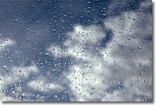
Weather Topic: What is Drizzle?
Home - Education - Precipitation - Drizzle
 Next Topic: Evaporation
Drizzle is precipitation in the form of water droplets which are
smaller than raindrops.
Drizzle is characterized by fine, gently falling droplets and typically does not
impact human habitation in a negative way. The exception to this is freezing drizzle,
a condition where drizzle freezes immediately upon reaching earth's surface.
Freezing drizzle is still less dangerous than freezing rain, but can
potentially result in hazardous road conditions.
Next Topic: Evaporation
Current conditions powered by WeatherAPI.com


