Weather Alert in New York
Lake Effect Snow Warning issued March 18 at 12:30AM EDT until March 18 at 8:00AM EDT by NWS Binghamton NY
AREAS AFFECTED: Onondaga; Madison
DESCRIPTION: * WHAT...Heavy lake effect snow. Additional snow accumulations up to 7 inches. * WHERE...Madison and Onondaga Counties. * WHEN...Until 8 AM EDT this morning. * IMPACTS...Plan on slippery road conditions. The hazardous conditions could impact the Wednesday morning commute. * ADDITIONAL DETAILS...Expect 5 to 10 inches of snow just north of Interstate 90, with much lower amounts of 1 to 3 inches south. Localized snowfall rates of 1 to 2 inches per hour at times will be possible. The snow quickly tapers off to scattered snow showers and flurries Wednesday morning. The highest snowfall amounts are expected in the Lakeport, Bridgeport, Clay, Cicero and Brewerton area. The City of Syracuse is forecast to see only 1 to 3 inches of snow.
INSTRUCTION: If you must travel, keep an extra flashlight, food, and water in your vehicle in case of an emergency. The latest road conditions for the state you are calling from can be obtained by calling 5 1 1. During lake effect snow, the weather can vary from bands of locally heavy snow to dry weather just a few miles away. Visibilities can also vary greatly. Be prepared for rapid changes in weather, visibility, and road conditions.
Want more detail? Get the Complete 7 Day and Night Detailed Forecast!
Current U.S. National Radar--Current
The Current National Weather Radar is shown below with a UTC Time (subtract 5 hours from UTC to get Eastern Time).

National Weather Forecast--Current
The Current National Weather Forecast and National Weather Map are shown below.

National Weather Forecast for Tomorrow
Tomorrow National Weather Forecast and Tomorrow National Weather Map are show below.

North America Water Vapor (Moisture)
This map shows recent moisture content over North America. Bright and colored areas show high moisture (ie, clouds); brown indicates very little moisture present; black indicates no moisture.

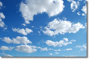
Weather Topic: What are Cumulonimbus Clouds?
Home - Education - Cloud Types - Cumulonimbus Clouds
 Next Topic: Cumulus Clouds
The final form taken by a growing cumulus cloud is the
cumulonimbus cloud, which is very tall and dense.
The tower of a cumulonimbus cloud can soar 23 km into the atmosphere, although
most commonly they stop growing at an altitude of 6 km.
Even small cumulonimbus clouds appear very large in comparison to other cloud types.
They can signal the approach of stormy weather, such as thunderstorms or blizzards.
Next Topic: Cumulus Clouds
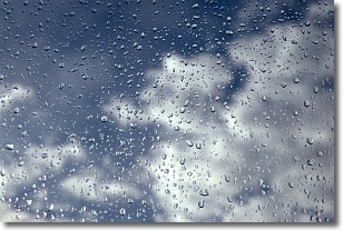
Weather Topic: What is Drizzle?
Home - Education - Precipitation - Drizzle
 Next Topic: Evaporation
Drizzle is precipitation in the form of water droplets which are
smaller than raindrops.
Drizzle is characterized by fine, gently falling droplets and typically does not
impact human habitation in a negative way. The exception to this is freezing drizzle,
a condition where drizzle freezes immediately upon reaching earth's surface.
Freezing drizzle is still less dangerous than freezing rain, but can
potentially result in hazardous road conditions.
Next Topic: Evaporation
Current conditions powered by WeatherAPI.com


