Weather Alert in Alaska
Winter Storm Warning issued February 28 at 5:49AM AKST until March 1 at 12:00PM AKST by NWS Juneau AK
AREAS AFFECTED: City of Hyder
DESCRIPTION: ...CENTRAL AND SOUTHERN PANHANDLE SNOW SATURDAY WITH POTENTIAL FOR MORE SNOW SUNDAY... Snowfall has increased in intensity and coverage overnight as a low tracks eastward across the Gulf towards the central panhandle. An estimated 2 to 4 inches has fallen overnight, these accumulations are separate from the next system set to affect the area through Saturday. Steady snowfall will continue through Saturday morning with rates increasing through the afternoon. Heaviest snowfall rates are expected to start by mid day along the coast, spreading eastward towards Hyder through Saturday night. As the low center tracks eastward through Saturday afternoon and evening, south to southwest wind will cause temperatures to warm over the southern outer coast with a mix or change to rain. Snow will then end on the NW side of the low, from Sitka to Juneau northward. Moisture will decrease overnight Saturday across the south, but then redevelop on Sunday as another system moves in. The rain/snow line will likely hover in vicinity of Sumner Strait Sunday into Monday with potential additional heavy snow for the Petersburg and Wrangell areas and lighter snow northward. A separate low pressure system looks to affect the region on Tuesday with potential for snow to push northward again. * WHAT...Heavy snow expected. Total snow accumulations of 11 to 14 inches. * WHERE...City of Hyder. * WHEN...From noon Saturday to noon AKST Sunday. * IMPACTS...Travel will be difficult. * ADDITIONAL DETAILS...Heaviest snowfall rates expected Saturday night. Mixing with rain is likely Sunday morning.
INSTRUCTION: If you must travel, keep an extra flashlight, food, and water with you in case of an emergency. People are urged to prepare their property before the onset of winter weather.
Want more detail? Get the Complete 7 Day and Night Detailed Forecast!
Current U.S. National Radar--Current
The Current National Weather Radar is shown below with a UTC Time (subtract 5 hours from UTC to get Eastern Time).

National Weather Forecast--Current
The Current National Weather Forecast and National Weather Map are shown below.

National Weather Forecast for Tomorrow
Tomorrow National Weather Forecast and Tomorrow National Weather Map are show below.

North America Water Vapor (Moisture)
This map shows recent moisture content over North America. Bright and colored areas show high moisture (ie, clouds); brown indicates very little moisture present; black indicates no moisture.

Weather Topic: What are Stratus Clouds?
Home - Education - Cloud Types - Stratus Clouds
 Next Topic: Wall Clouds
Stratus clouds are similar to altostratus clouds, but form at a
lower altitude and are identified by their fog-like appearance, lacking the
distinguishing features of most clouds.
Stratus clouds are wider than most clouds, and their base has a smooth, uniform
look which is lighter in color than a nimbostratus cloud.
The presence of a stratus cloud indicates the possibility of minor precipitation,
such as drizzle, but heavier precipitation does not typically arrive in the form
of a stratus cloud.
Next Topic: Wall Clouds
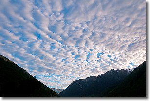
Weather Topic: What are Altocumulus Clouds?
Home - Education - Cloud Types - Altocumulus Clouds
 Next Topic: Altostratus Clouds
Similar to cirrocumulus clouds, altocumulus clouds are
characterized by cloud patches. They are distinguished by larger cloudlets
than cirrocumulus clouds but are still smaller than stratocumulus clouds.
Altocumulus clouds most commonly form in middle altitudes (between 2 and 5 km)
and may resemble, at times, the shape of a flying saucer.
These uncommon formations, called altocumulus lenticularis, are created by uplift
in the atmosphere and are most often seen in close proximity to mountains.
Next Topic: Altostratus Clouds
Current conditions powered by WeatherAPI.com


