Weather Alert in New Mexico
Red Flag Warning issued March 4 at 10:05PM MST until March 5 at 7:00PM MST by NWS El Paso Tx/Santa Teresa NM
AREAS AFFECTED: Capitan And Sacramento Mountains
DESCRIPTION: ...CRITICAL FIRE WEATHER CONDITIONS FOR THE SACRAMENTO MOUNTAINS OF SOUTHERN NEW MEXICO... .An upper level storm system will give us strong strong surface winds of 20 to 30 mph on Thursday afternoon. These winds combined with low min RH of 10 to 15% will create critical fire weather conditions in the Sacramento Mountains. Winds could gust as high as 45 to 50 mph. The winds will continue through much of Thursday night into Friday morning, but min RH's will rise above critical levels Thursday evening. The rest of the region will also see elevated winds and critically low RH, but fuels are not yet critically dry in those areas, with the exception of grasses. * AFFECTED AREA...Fire Weather Zone 113 Capitan and Sacramento Mountains/Lincoln NF/LNZ. * TIMING...11 AM TO 7 PM Thursday * WINDS...Southwest 20 to 30 mph with gusts 45 to 50 mph. * RELATIVE HUMIDITY...As low as 8 percent. * TEMPERATURES...Up to 71. * IMPACTS...Any fires that develop will likely spread rapidly. Outdoor burning is not recommended
INSTRUCTION: A Red Flag Warning means that critical fire weather conditions are either occurring now, or will shortly. A combination of strong winds, low relative humidity, and warm temperatures can contribute to extreme fire behavior.
Want more detail? Get the Complete 7 Day and Night Detailed Forecast!
Current U.S. National Radar--Current
The Current National Weather Radar is shown below with a UTC Time (subtract 5 hours from UTC to get Eastern Time).

National Weather Forecast--Current
The Current National Weather Forecast and National Weather Map are shown below.

National Weather Forecast for Tomorrow
Tomorrow National Weather Forecast and Tomorrow National Weather Map are show below.

North America Water Vapor (Moisture)
This map shows recent moisture content over North America. Bright and colored areas show high moisture (ie, clouds); brown indicates very little moisture present; black indicates no moisture.

Weather Topic: What is Drizzle?
Home - Education - Precipitation - Drizzle
 Next Topic: Evaporation
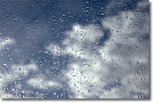
Drizzle is precipitation in the form of water droplets which are
smaller than raindrops.
Drizzle is characterized by fine, gently falling droplets and typically does not
impact human habitation in a negative way. The exception to this is freezing drizzle,
a condition where drizzle freezes immediately upon reaching earth's surface.
Freezing drizzle is still less dangerous than freezing rain, but can
potentially result in hazardous road conditions.
Next Topic: Evaporation
Weather Topic: What is Fog?
Home - Education - Cloud Types - Fog
 Next Topic: Fractus Clouds
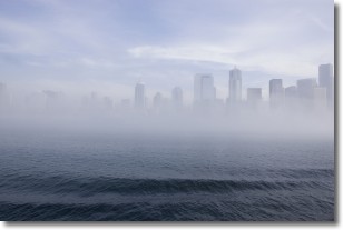
Fog is technically a type of stratus cloud, which lies along the
ground and obscures visibility.
It is usually created when humidity in the air condenses into tiny water droplets.
Because of this, some places are more prone to foggy weather, such as regions
close to a body of water.
Fog is similar to mist; both are the appearance of water droplets suspended in
the air, but fog is the term applied to the condition when visibility is less than 1 km.
Next Topic: Fractus Clouds
Current conditions powered by WeatherAPI.com


