Weather Alert in Nevada
Special Weather Statement issued August 27 at 2:23PM PDT by NWS Reno NV
AREAS AFFECTED: Mineral and Southern Lyon Counties; Greater Lake Tahoe Area; Greater Reno-Carson City-Minden Area; Western Nevada Basin and Range including Pyramid Lake
DESCRIPTION: At 223 PM PDT, Doppler radar was tracking a cluster of strong thunderstorms over Dayton, or near Virginia City, moving east at 20 mph. HAZARD...Wind gusts up to 40 mph and pea size hail. SOURCE...Radar indicated. IMPACT...Gusty winds could knock down tree limbs and blow around unsecured objects. Minor hail damage to vegetation is possible. Locations impacted include... Carson City, Virginia City, Dayton, Washoe City, Damonte Ranch, Pleasant Valley, Carson City Airport, Galena, New Washoe City, Indian Hills, Washoe Lake Campground, Us 395 At Douglas-Carson City Co Line, Lakeview, Rawe Peak, Gold Hill, Davis Creek Campground, Stewart, Junction U.S 50 And Six Mile Canyon-Ft Churchill Rd, Us 50 At Carson City-Lyon Co Line, and Junction U.S 50 And NV 341.
INSTRUCTION: If outdoors, consider seeking shelter inside a building.
Want more detail? Get the Complete 7 Day and Night Detailed Forecast!
Current U.S. National Radar--Current
The Current National Weather Radar is shown below with a UTC Time (subtract 5 hours from UTC to get Eastern Time).

National Weather Forecast--Current
The Current National Weather Forecast and National Weather Map are shown below.

National Weather Forecast for Tomorrow
Tomorrow National Weather Forecast and Tomorrow National Weather Map are show below.

North America Water Vapor (Moisture)
This map shows recent moisture content over North America. Bright and colored areas show high moisture (ie, clouds); brown indicates very little moisture present; black indicates no moisture.

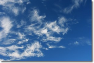
Weather Topic: What are Altostratus Clouds?
Home - Education - Cloud Types - Altostratus Clouds
 Next Topic: Cirrocumulus Clouds
Altostratus clouds form at mid to high-level altitudes
(between 2 and 7 km) and are created by a warm, stable air mass which causes
water vapor
to condense as it rise through the atmosphere. Usually altostratus clouds are
featureless sheets characterized by a uniform color.
In some cases, wind punching through the cloud formation may give it a waved
appearance, called altostratus undulatus. Altostratus clouds
are commonly seen with other cloud formations accompanying them.
Next Topic: Cirrocumulus Clouds
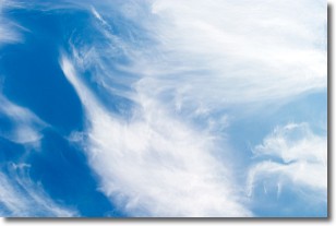
Weather Topic: What are Cirrostratus Clouds?
Home - Education - Cloud Types - Cirrostratus Clouds
 Next Topic: Cirrus Clouds
Cirrostratus clouds are high, thin clouds that form above
20,000 feet and are made mostly of ice crystals. They sometimes look like giant
feathers, horse tails, or curls of hair in the sky.
These clouds are pushed by the jet stream and can move at high speeds reaching
100 mph.
What do they indicate?
They indicate that a precipitation is likely within 24 hours.
Next Topic: Cirrus Clouds
Current conditions powered by WeatherAPI.com


