Weather Alert in Texas
Flood Warning issued May 1 at 8:56PM CDT by NWS Fort Worth TX
AREAS AFFECTED: Henderson, TX; Navarro, TX
DESCRIPTION: ...The Flood Warning is extended for the following rivers in Texas... Cowleech Fork Sabine River At Greenville affecting Hunt County. South Fork Sabine River Near Quinlan affecting Rockwall and Hunt Counties. Big Sandy Creek Near Bridgeport affecting Wise County. West Fork Trinity River Near Jacksboro affecting Jack County. Denton Creek Near Justin affecting Denton County. Trinity River At Dallas affecting Dallas County. Trinity River Near Long Lake (Oakwood) affecting Anderson, Leon and Freestone Counties. Brazos River Near South Bend affecting Young County. ...The Flood Warning continues for the following rivers in Texas... West Fork Trinity River Near Boyd affecting Wise County. Trinity River At Trinidad affecting Henderson and Navarro Counties. ...The Flood Warning is cancelled for the following rivers in Texas... Chambers Creek Near Rice affecting Navarro County. * WHAT...Minor flooding is occurring and moderate flooding is forecast. * WHERE...Trinity River at Trinidad. * WHEN...Until further notice. * IMPACTS...At 40.0 feet, Moderate flooding will occur along the right bank to agricultural fields and the cattle industry. * ADDITIONAL DETAILS... - At 8:00 PM CDT Thursday the stage was 35.2 feet. - Bankfull stage is 33.0 feet. - Flood stage is 33.0 feet. - Forecast...The river is expected to rise to a crest of 40.1 feet early Sunday morning.
INSTRUCTION: Do not drive cars through flooded areas. Caution is urged when walking near riverbanks. Additional information is available at www.water.noaa.gov/wfo/FWD.
Want more detail? Get the Complete 7 Day and Night Detailed Forecast!
Current U.S. National Radar--Current
The Current National Weather Radar is shown below with a UTC Time (subtract 5 hours from UTC to get Eastern Time).

National Weather Forecast--Current
The Current National Weather Forecast and National Weather Map are shown below.

National Weather Forecast for Tomorrow
Tomorrow National Weather Forecast and Tomorrow National Weather Map are show below.

North America Water Vapor (Moisture)
This map shows recent moisture content over North America. Bright and colored areas show high moisture (ie, clouds); brown indicates very little moisture present; black indicates no moisture.

Weather Topic: What is Drizzle?
Home - Education - Precipitation - Drizzle
 Next Topic: Evaporation
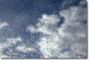
Drizzle is precipitation in the form of water droplets which are
smaller than raindrops.
Drizzle is characterized by fine, gently falling droplets and typically does not
impact human habitation in a negative way. The exception to this is freezing drizzle,
a condition where drizzle freezes immediately upon reaching earth's surface.
Freezing drizzle is still less dangerous than freezing rain, but can
potentially result in hazardous road conditions.
Next Topic: Evaporation
Weather Topic: What is Fog?
Home - Education - Cloud Types - Fog
 Next Topic: Fractus Clouds
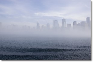
Fog is technically a type of stratus cloud, which lies along the
ground and obscures visibility.
It is usually created when humidity in the air condenses into tiny water droplets.
Because of this, some places are more prone to foggy weather, such as regions
close to a body of water.
Fog is similar to mist; both are the appearance of water droplets suspended in
the air, but fog is the term applied to the condition when visibility is less than 1 km.
Next Topic: Fractus Clouds
Current conditions powered by WeatherAPI.com


