Weather Alert in Missouri
Flood Warning issued March 7 at 7:30PM CST until March 10 at 7:00AM CDT by NWS St Louis MO
AREAS AFFECTED: Jefferson, MO; St. Louis, MO
DESCRIPTION: ...The Flood Warning is extended for the following rivers in Missouri... Meramec River at Pacific. Meramec River at Valley Park. Meramec River near Eureka. Big River at Byrnesville. Meramec River near Steelville. ...The Flood Warning continues for the following rivers in Missouri... Meramec River near Sullivan. Meramec River at Fenton. River forecasts are based on observed precipitation and forecast precipitation for the next 48 hours. * WHAT...Minor flooding is forecast. * WHERE...Meramec River at Fenton. * WHEN...From late Sunday night to Tuesday morning. * IMPACTS...At 22.9 feet, At this height, the entire boat ramp path at Minnie Ha Ha Park will be submerged. * ADDITIONAL DETAILS... - At 7:15 PM CST Saturday the stage was 20.2 feet. - Forecast...The river will rise to flood stage early Monday morning. It will then fall to 21.8 feet Tuesday morning. It will rise to 21.9 feet early Tuesday afternoon. It will then fall again and remain below flood stage. - Flood stage is 23.0 feet.
INSTRUCTION: Turn around, don't drown when encountering flooded roads. Most flood deaths occur in vehicles. Motorists should not attempt to drive around barricades or drive cars through flooded areas. Be especially cautious at night when it is harder to recognize the dangers of flooding. This product, along with additional weather and stream information, is available at https://water.noaa.gov/wfo/lsx
Want more detail? Get the Complete 7 Day and Night Detailed Forecast!
Current U.S. National Radar--Current
The Current National Weather Radar is shown below with a UTC Time (subtract 5 hours from UTC to get Eastern Time).

National Weather Forecast--Current
The Current National Weather Forecast and National Weather Map are shown below.

National Weather Forecast for Tomorrow
Tomorrow National Weather Forecast and Tomorrow National Weather Map are show below.

North America Water Vapor (Moisture)
This map shows recent moisture content over North America. Bright and colored areas show high moisture (ie, clouds); brown indicates very little moisture present; black indicates no moisture.

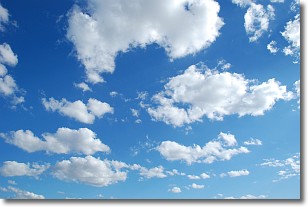
Weather Topic: What are Cumulonimbus Clouds?
Home - Education - Cloud Types - Cumulonimbus Clouds
 Next Topic: Cumulus Clouds
The final form taken by a growing cumulus cloud is the
cumulonimbus cloud, which is very tall and dense.
The tower of a cumulonimbus cloud can soar 23 km into the atmosphere, although
most commonly they stop growing at an altitude of 6 km.
Even small cumulonimbus clouds appear very large in comparison to other cloud types.
They can signal the approach of stormy weather, such as thunderstorms or blizzards.
Next Topic: Cumulus Clouds
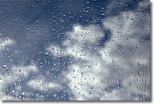
Weather Topic: What is Drizzle?
Home - Education - Precipitation - Drizzle
 Next Topic: Evaporation
Drizzle is precipitation in the form of water droplets which are
smaller than raindrops.
Drizzle is characterized by fine, gently falling droplets and typically does not
impact human habitation in a negative way. The exception to this is freezing drizzle,
a condition where drizzle freezes immediately upon reaching earth's surface.
Freezing drizzle is still less dangerous than freezing rain, but can
potentially result in hazardous road conditions.
Next Topic: Evaporation
Current conditions powered by WeatherAPI.com


