Weather Alert in Wisconsin
Special Weather Statement issued August 22 at 4:25PM CDT by NWS Green Bay WI
AREAS AFFECTED: Vilas; Oneida; Forest; Florence; Lincoln
DESCRIPTION: At 425 PM CDT, Doppler radar was tracking a cluster of strong thunderstorms along a line extending from 9 miles east of Phelps to near Kentuck Lake Campground to 7 miles north of Tomahawk. Movement was east at 25 mph. HAZARD...Wind gusts up to 40 mph and pea size hail. SOURCE...Radar indicated. IMPACT...Gusty winds could knock down tree limbs and blow around unsecured objects. Minor hail damage to vegetation is possible. Strong thunderstorms will be near... Rhinelander, Woodboro, and Crystal Lake Scout Reservation around 430 PM CDT. Headwaters Wilderness around 435 PM CDT. Wisconsin Slough Natural Area around 450 PM CDT. Tipler around 455 PM CDT. Popple River around 500 PM CDT. Other locations impacted by these storms include Gagen, Luna-White Deer Campground, Popple River Headwaters Natural Area, Bastile Lake Natural Area, Bradley, Anvil Lake Campground, Lower Tomahawk River Natural Area, Harshaw, Argonne, and Mccord.
INSTRUCTION: If outdoors, consider seeking shelter inside a building. Persons in campgrounds should consider seeking sturdy shelter until these storms pass.
Want more detail? Get the Complete 7 Day and Night Detailed Forecast!
Current U.S. National Radar--Current
The Current National Weather Radar is shown below with a UTC Time (subtract 5 hours from UTC to get Eastern Time).

National Weather Forecast--Current
The Current National Weather Forecast and National Weather Map are shown below.

National Weather Forecast for Tomorrow
Tomorrow National Weather Forecast and Tomorrow National Weather Map are show below.

North America Water Vapor (Moisture)
This map shows recent moisture content over North America. Bright and colored areas show high moisture (ie, clouds); brown indicates very little moisture present; black indicates no moisture.

Weather Topic: What are Cumulus Clouds?
Home - Education - Cloud Types - Cumulus Clouds
 Next Topic: Drizzle
Cumulus clouds are fluffy and textured with rounded tops, and
may have flat bottoms. The border of a cumulus cloud
is clearly defined, and can have the appearance of cotton or cauliflower.
Cumulus clouds form at low altitudes (rarely above 2 km) but can grow very tall,
becoming cumulus congestus and possibly the even taller cumulonimbus clouds.
When cumulus clouds become taller, they have a greater chance of producing precipitation.
Next Topic: Drizzle
Weather Topic: What is Evaporation?
Home - Education - Precipitation - Evaporation
 Next Topic: Fog
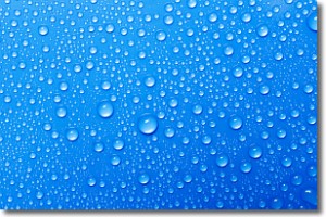
Evaporation is the process which returns water from the earth
back to the atmosphere, and is another crucial process in the water cycle.
Evaporation is the transformation of liquid into gas, and it happens because
molecules are excited by the application of energy and turn into vapor.
In order for water to evaporate it has to be on the surface of a body of water.
Next Topic: Fog
Current conditions powered by WeatherAPI.com


