Weather Alert in Texas
Flash Flood Warning issued July 5 at 8:48AM CDT until July 5 at 12:00PM CDT by NWS Austin/San Antonio TX
AREAS AFFECTED: Burnet, TX; Travis, TX; Williamson, TX
DESCRIPTION: FFWEWX The National Weather Service in Austin/San Antonio has extended the * Flash Flood Warning for... Burnet County in south central Texas... Northwestern Travis County in south central Texas... Northwestern Williamson County in south central Texas... * Until noon CDT. * At 848 AM CDT, Automated rain gauges and area Cocorahs reported between 6 and 14 inches of rain have fallen. Additional rainfall amounts up to 1 inch are possible in the warned area. Flash flooding is already occurring. This is a FLASH FLOOD EMERGENCY for Much of Burnet County and western Parts of Williamson and Travis County. This is a PARTICULARLY DANGEROUS SITUATION. SEEK HIGHER GROUND NOW! HAZARD...Life threatening flash flooding. Thunderstorms producing flash flooding. SOURCE...Radar and automated gauges. IMPACT...This is a PARTICULARLY DANGEROUS SITUATION. SEEK HIGHER GROUND NOW! Life threatening flash flooding of low water crossings, small creeks and streams, urban areas, highways, streets and underpasses. * Some locations that will experience flash flooding include... Burnet, Marble Falls, Kingsland, Bertram, Buchanan Dam, Leander, Lago Vista, Granite Shoals, Horseshoe Bay, Meadowlakes, Liberty Hill, Buchanan Lake Village, Highland Haven, Shady Grove, Oatmeal, Joppa, Lake Victor, Sunnylane, Watson and Mahomet.
INSTRUCTION: Move to higher ground now! This is an extremely dangerous and life-threatening situation. Do not attempt to travel unless you are fleeing an area subject to flooding or under an evacuation order. Turn around, don't drown when encountering flooded roads. Most flood deaths occur in vehicles. Be aware of your surroundings and do not drive on flooded roads. Stay away or be swept away. River banks and culverts can become unstable and unsafe. Flooding is occurring or is imminent. It is important to know where you are relative to streams, rivers, or creeks which can become killers in heavy rains. Campers and hikers should avoid streams or creeks.
Want more detail? Get the Complete 7 Day and Night Detailed Forecast!
Current U.S. National Radar--Current
The Current National Weather Radar is shown below with a UTC Time (subtract 5 hours from UTC to get Eastern Time).

National Weather Forecast--Current
The Current National Weather Forecast and National Weather Map are shown below.

National Weather Forecast for Tomorrow
Tomorrow National Weather Forecast and Tomorrow National Weather Map are show below.

North America Water Vapor (Moisture)
This map shows recent moisture content over North America. Bright and colored areas show high moisture (ie, clouds); brown indicates very little moisture present; black indicates no moisture.

Weather Topic: What are Wall Clouds?
Home - Education - Cloud Types - Wall Clouds
 Next Topic: Altocumulus Clouds
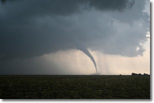
A wall cloud forms underneath the base of a cumulonimbus cloud,
and can be a hotbed for deadly tornadoes.
Wall clouds are formed by air flowing into the cumulonimbus clouds, which can
result in the wall cloud descending from the base of the cumulonimbus cloud, or
rising fractus clouds which join to the base of the storm cloud as the wall cloud
takes shape.
Wall clouds can be very large, and in the Northern Hemisphere they generally
form at the southern edge of cumulonimbus clouds.
Next Topic: Altocumulus Clouds
Weather Topic: What are Altostratus Clouds?
Home - Education - Cloud Types - Altostratus Clouds
 Next Topic: Cirrocumulus Clouds
Altostratus clouds form at mid to high-level altitudes
(between 2 and 7 km) and are created by a warm, stable air mass which causes
water vapor
to condense as it rise through the atmosphere. Usually altostratus clouds are
featureless sheets characterized by a uniform color.
In some cases, wind punching through the cloud formation may give it a waved
appearance, called altostratus undulatus. Altostratus clouds
are commonly seen with other cloud formations accompanying them.
Next Topic: Cirrocumulus Clouds
Current conditions powered by WeatherAPI.com


