Weather Alert in Maine
Special Weather Statement
Special Weather Statement issued August 22 at 8:39AM EDT by NWS Gray ME
AREAS AFFECTED: Interior York; Central Interior Cumberland; Androscoggin; Kennebec; Interior Waldo; Coastal York; Coastal Cumberland; Sagadahoc; Lincoln; Knox; Coastal Waldo; Interior Cumberland Highlands; Strafford; Eastern Hillsborough; Interior Rockingham; Coastal Rockingham
DESCRIPTION: A very dry air mass and breezy conditions will combine with dead and dry fuels such as grass, leaves, and twigs to create the potential for uncontrolled fire spread across the coastal plain of Maine and southeast New Hampshire today. This afternoon, relative humidity values will decrease to low levels between 25 to 30 R.H. %. At the same time, north to northeast| winds between 10 to 15 mph with frequent gusts to 20 mph will continue to dry fuels and increase fire spread potential. Near the coast, a sea breeze will develop this afternoon with southeast winds gusting to 20 mph. Wind gusts are expected to diminish later this evening with increasing relative humidity values. Extra caution should be taken to prevent wildfires. Always consult with fire officials before engaging in any open burning activities and comply with all applicable laws and regulations. Never leave an open fire unattended and always extinguish campfires completely before leaving.
INSTRUCTION: N/A
Want more detail? Get the Complete 7 Day and Night Detailed Forecast!
Current U.S. National Radar--Current
The Current National Weather Radar is shown below with a UTC Time (subtract 5 hours from UTC to get Eastern Time).

National Weather Forecast--Current
The Current National Weather Forecast and National Weather Map are shown below.

National Weather Forecast for Tomorrow
Tomorrow National Weather Forecast and Tomorrow National Weather Map are show below.

North America Water Vapor (Moisture)
This map shows recent moisture content over North America. Bright and colored areas show high moisture (ie, clouds); brown indicates very little moisture present; black indicates no moisture.

Weather Topic: What is Condensation?
Home - Education - Precipitation - Condensation
 Next Topic: Contrails
Condensation is the process which creates clouds, and therefore
it is a crucial process in the water cycle.
Condensation is the change of matter from a state of gas into a state of liquid,
and it happens because water molecules release heat into the atmosphere and
become organized into a more closely packed structure, what we might see as
water droplets.
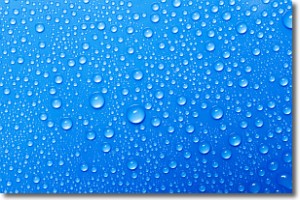
Water is always present in the air around us as a vapor, but it's too small for
us to see. When water undergoes the process of condensation it becomes organized
into visible water droplets. You've probably seen condensation happen before on the
surface of a cold drink!
Next Topic: Contrails
Weather Topic: What are Cumulonimbus Clouds?
Home - Education - Cloud Types - Cumulonimbus Clouds
 Next Topic: Cumulus Clouds
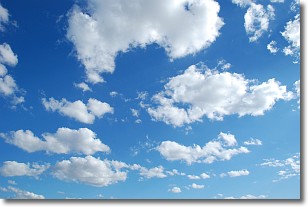
The final form taken by a growing cumulus cloud is the
cumulonimbus cloud, which is very tall and dense.
The tower of a cumulonimbus cloud can soar 23 km into the atmosphere, although
most commonly they stop growing at an altitude of 6 km.
Even small cumulonimbus clouds appear very large in comparison to other cloud types.
They can signal the approach of stormy weather, such as thunderstorms or blizzards.
Next Topic: Cumulus Clouds
Current conditions powered by WeatherAPI.com


