Weather Alert in New York
Winter Storm Warning issued February 23 at 12:44AM EST until February 23 at 7:00PM EST by NWS Albany NY
AREAS AFFECTED: Eastern Rensselaer; Bennington; Western Windham; Eastern Windham
DESCRIPTION: * WHAT...Heavy snow and blowing snow. Additional snow accumulations between 3 and 9 inches. Total snow accumulations 4 to 12 inches. Winds gusting as high as 45 mph. * WHERE...In eastern New York, Eastern Rensselaer County. In Vermont, Bennington, and Windham Counties. * WHEN...Until 7 PM EST this evening. * IMPACTS...Travel could be difficult. Visibility will be reduced this morning due to falling and blowing snow. The hazardous conditions could impact the morning commute and possibly the evening commute as well for eastern areas. * ADDITIONAL DETAILS...A powerful nor'easter will impact the region today. There will be a sharp gradient of snowfall totals and the higher snowfall amounts will be favored across the higher elevations and southern parts of the area. Snowfall rates could approach one inch per hour within bands this morning.
INSTRUCTION: If you must travel, keep an extra flashlight, food, and water in your vehicle in case of an emergency.
Want more detail? Get the Complete 7 Day and Night Detailed Forecast!
Current U.S. National Radar--Current
The Current National Weather Radar is shown below with a UTC Time (subtract 5 hours from UTC to get Eastern Time).

National Weather Forecast--Current
The Current National Weather Forecast and National Weather Map are shown below.

National Weather Forecast for Tomorrow
Tomorrow National Weather Forecast and Tomorrow National Weather Map are show below.

North America Water Vapor (Moisture)
This map shows recent moisture content over North America. Bright and colored areas show high moisture (ie, clouds); brown indicates very little moisture present; black indicates no moisture.

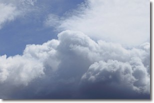
Weather Topic: What are Nimbostratus Clouds?
Home - Education - Cloud Types - Nimbostratus Clouds
 Next Topic: Precipitation
A nimbostratus cloud is similar to a stratus cloud in its formless,
smooth appearance. However, a nimbostratus cloud is darker than a stratus cloud,
because it is thicker.
Unlike a stratus cloud, a nimbostratus cloud typically brings with it the threat
of moderate to heavy precipitation. In some cases, the precipitation may evaporate
before reaching the ground, a phenomenon known as virga.
Next Topic: Precipitation
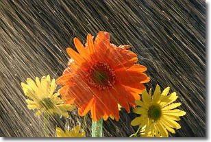
Weather Topic: What is Rain?
Home - Education - Precipitation - Rain
 Next Topic: Shelf Clouds
Precipitation in the form of water droplets is called rain.
Rain generally has a tendency to fall with less intensity over a greater period
of time, and when rainfall is more severe it is usually less sustained.
Rain is the most common form of precipitation and happens with greater frequency
depending on the season and regional influences. Cities have been shown to have
an observable effect on rainfall, due to an effect called the urban heat island.
Compared to upwind, monthly rainfall between twenty and forty miles downwind of
cities is 30% greater.
Next Topic: Shelf Clouds
Current conditions powered by WeatherAPI.com


