Weather Alert in Kentucky
Special Weather Statement issued February 23 at 5:08PM EST by NWS Jackson KY
AREAS AFFECTED: Fleming; Montgomery; Bath; Rowan; Estill; Powell; Menifee; Rockcastle; Jackson; Pulaski; Laurel; McCreary; Whitley; Knox; Elliott; Morgan; Johnson; Wolfe; Magoffin; Lee; Breathitt; Owsley; Clay
DESCRIPTION: Some light snow accumulations are anticipated this evening as scattered to numerous now showers track across the area. The snow showers will be most persistent east of I-75, however, portions of the Interstate 75 corridor between the KY and TN border and the Rockcastle and Madison county line may be affected. Wind gusts as high as 20 to 25 mph could occur in the heavier snow showers. This, when combined with the falling snow, may result in sudden sharp visibility reductions over short distances and quick light snow accumulations. Temperatures will be in the 20s and as the evening progresses, expect times of slick, slushy, or snow covered roads. Any untreated roads and surfaces, including bridges, overpasses, decks, and steps may be icy. If traveling this, slow down and exercise caution. Allow plenty of extra time to reach your destination.
INSTRUCTION: N/A
Want more detail? Get the Complete 7 Day and Night Detailed Forecast!
Current U.S. National Radar--Current
The Current National Weather Radar is shown below with a UTC Time (subtract 5 hours from UTC to get Eastern Time).

National Weather Forecast--Current
The Current National Weather Forecast and National Weather Map are shown below.

National Weather Forecast for Tomorrow
Tomorrow National Weather Forecast and Tomorrow National Weather Map are show below.

North America Water Vapor (Moisture)
This map shows recent moisture content over North America. Bright and colored areas show high moisture (ie, clouds); brown indicates very little moisture present; black indicates no moisture.

Weather Topic: What are Hole Punch Clouds?
Home - Education - Cloud Types - Hole Punch Clouds
 Next Topic: Mammatus Clouds
A hole punch cloud is an unusual occurrence when a disk-shaped
hole appears in a cirrostratus, cirrocumulus, or altocumulus cloud.
When part of the cloud forms ice crystals, water droplets in the surrounding area
of the cloud evaporate. The effect of this process produces a large elliptical
gap in the cloud. The hole punch cloud formation is rare, but it is not specific
to any geographic area.
Other names which have been used to describe this phenomena include fallstreak hole,
skypunch, and cloud hole.
Next Topic: Mammatus Clouds
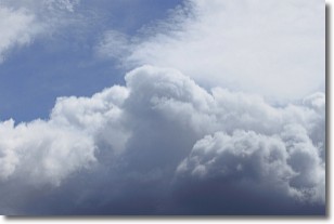
Weather Topic: What are Nimbostratus Clouds?
Home - Education - Cloud Types - Nimbostratus Clouds
 Next Topic: Precipitation
A nimbostratus cloud is similar to a stratus cloud in its formless,
smooth appearance. However, a nimbostratus cloud is darker than a stratus cloud,
because it is thicker.
Unlike a stratus cloud, a nimbostratus cloud typically brings with it the threat
of moderate to heavy precipitation. In some cases, the precipitation may evaporate
before reaching the ground, a phenomenon known as virga.
Next Topic: Precipitation
Current conditions powered by WeatherAPI.com


