Weather Alert in Idaho
Avalanche Watch issued February 23 at 1:51PM MST by NWS Boise ID
AREAS AFFECTED: Adams, ID; Idaho, ID; Valley, ID
DESCRIPTION: The following message is transmitted at the request of the Payette National Forest Avalanche Center. ...The Payette National Forest Avalanche Center in McCall Idaho has issued a BACKCOUNTRY AVALANCHE WATCH... * WHAT...An Avalanche Watch is in effect. Expect very dangerous avalanche conditions to develop over the next 24-48 hours. Heavy snowfall, wind, and rainfall will overload the current snowpack setup. * WHERE...The Salmon River Mountains, the West Mountains, and the surrounding mountain areas. * WHEN...In effect from Mon 12:00 MST to Tue 12:00 MST. * IMPACTS...Natural and human-triggered avalanches large enough to bury people are very likely to occur within 24-48 hours of this issuance. Avalanches may connect across terrain features like ridges or release multiple start zones at once. Additionally, rainfall to 7,000 feet will weaken surface snow and increase the likelihood of larger loose avalanches, as well as avalanches that break deeper within the snowpack. Smaller slopes, such as roadcuts, may also avalanche, depositing a surprising amount of debris on the road below.
INSTRUCTION: Anticipate conditions that dictate staying off and out from below steep slopes - slopes steeper than about 30 degrees. Travel in avalanche terrain is not recommended per this upcoming timeframe. Natural and human-triggered avalanches may occur in unexpected or surprising ways, travel farther than anticipated, and impact gentler terrain below. Even small but steep terrain features, such as road cuts or rooftops holding old snow, may be hazardous. Consult WWW.PAYETTEAVALANCHE.ORG or WWW.AVALANCHE.ORG for more detailed information. Similar avalanche danger may exist at locations outside the coverage area of this or any avalanche center. LAT...LON 4539 11600 4520 11584 4513 11579 4455 11577 4455 11603 4439 11600 4427 11613 4440 11627 4479 11635 4497 11622 4527 11633 4535 11635 4539 11629
Want more detail? Get the Complete 7 Day and Night Detailed Forecast!
Current U.S. National Radar--Current
The Current National Weather Radar is shown below with a UTC Time (subtract 5 hours from UTC to get Eastern Time).

National Weather Forecast--Current
The Current National Weather Forecast and National Weather Map are shown below.

National Weather Forecast for Tomorrow
Tomorrow National Weather Forecast and Tomorrow National Weather Map are show below.

North America Water Vapor (Moisture)
This map shows recent moisture content over North America. Bright and colored areas show high moisture (ie, clouds); brown indicates very little moisture present; black indicates no moisture.

Weather Topic: What is Sleet?
Home - Education - Precipitation - Sleet
 Next Topic: Snow
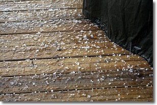
Sleet is a form of precipitation in which small ice pellets are the primary
components. These ice pellets are smaller and more translucent than hailstones,
and harder than graupel. Sleet is caused by specific atmospheric conditions and
therefore typically doesn't last for extended periods of time.
The condition which leads to sleet formation requires a warmer body of air to be
wedged in between two sub-freezing bodies of air. When snow falls through a warmer
layer of air it melts, and as it falls through the next sub-freezing body of air
it freezes again, forming ice pellets known as sleet. In some cases, water
droplets don't have time to freeze before reaching the surface and the result is
freezing rain.
Next Topic: Snow
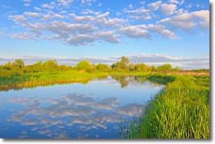
Weather Topic: What are Stratocumulus Clouds?
Home - Education - Cloud Types - Stratocumulus Clouds
 Next Topic: Stratus Clouds
Stratocumulus clouds are similar to altocumulus clouds in their
fluffy appearance, but have a slightly darker shade due to their additional mass.
A good way to distinguish the two cloud types is to hold your hand out and measure
the size of an individual cloud; if it is the size of your thumb it is generally
an altocumulus cloud, if it is the size of your hand it is generally a
stratocumulus cloud.
It is uncommon for stratocumulus clouds to produce precipitation, but if they do
it is usually a light rain or snow.
Next Topic: Stratus Clouds
Current conditions powered by WeatherAPI.com


